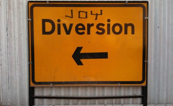
On Saturday 27th April, Joy Diversion returned for the first time this year. Despite having been visited Storm Hannah the night before, our intrepid explorers weren’t put off and we had a strong turnout. Boots and waterproofs were donned, and as usual explorers gathered at The Federation to pore over various maps of Manchester from the 1800s onwards and propose expeditions.
There were five teams in total, and what follows is a brief summary of their mission and findings (sadly due to a twitter account being private, we don’t have access to Team Albatross’ expedition down Oxford Road…):
Team Turtle
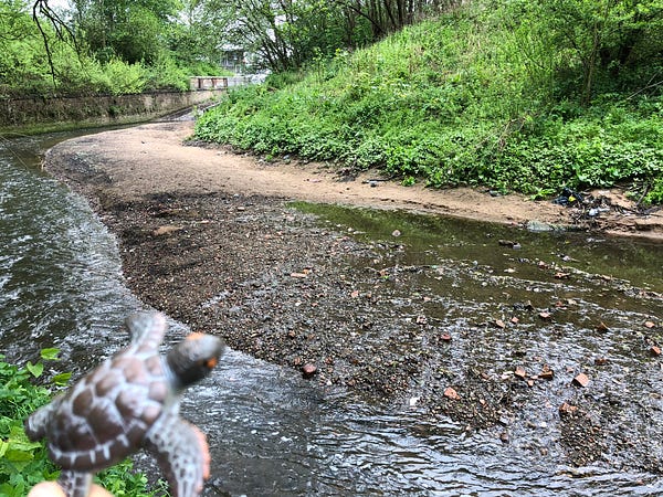
Team Turtle began exploring the boundaries of different political wards to see how they’d changed over the years, as well as locating street names with real nouns in them. A surprising find was how green and wild the River Medlock area is behind Piccadilly on the far side of the Mancunian Way.
Mission: Explore the boundaries of political wards
Findings: A surprisingly green and wild area in the city centre.
Artefacts: Fragments of an old glass bottle, potentially from a local warehouse.
View a full timeline of their expedition.
Team Tiger

Team Tiger stayed closer to home, exploring the immediate surroundings around The Federation and NOMA, but gave us a more in depth exploration of how the streets have changed, including the addition of new roads and noting subtle changes in direction to older, pre-existing ones such as Balloon Street.
Mission: Victoria Station and NOMA — how have the streets changed?
Findings: Some new additions, some subtle directional changes to older streets.
Artefacts: None.
View a full timeline of their expedition.
Team Alligator
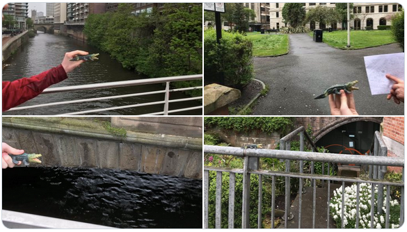
Team Alligator wanted to walk the trails of subterranean Manchester, to find old tunnels and see if there was any way of gaining access. Although some entrance points were found, they were (perhaps unsurprisingly) off-bounds to the general public. The sites of the old underground markets off Market Street were also revisited, the existence of which came as a surprise those newer to Manchester!
Mission: Explore subterranean Manchester
Findings: A few access points, no accessible entrances.
Artefacts: None.
View a full timeline of their expedition.
Team Moose
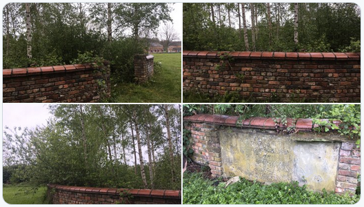
Finally, Team Moose went off towards Ancoats in search of churches that appeared on the maps in 1848. Which were still standing and which were now gone? Sadly, it seems the only one they found still in existence, (on Every Street) has now been de-consecrated and is condemned.
They had a secondary mission to document street names that feature people’s names and to note the gender split. They found 9 male names and 1 female name, plus the contested “Blossom”.
Mission: Ancoats, old churches & street names with names.
Findings: Many empty spaces where churches once stood. Only one mapped church, now derelict.
Male street names: Oswald, Clive, William Chadwick, Brian Hughes, Nobby Stiles, George Leigh, Henry, Isaac, Oswald
Female streeet names: Anita, Blossom (?)
Artefacts: a rather apt moose antler made from wire frame.
View a full timeline of their expedition.
And that was it! Another successful and fun-filled Joy Diversion. If you were unable to make it, or would like to join the next one, we’ll be running another session on Saturday 15thJune.
Follw us on Twitter or sign up to our monthly mailer to be kept in the loop.