
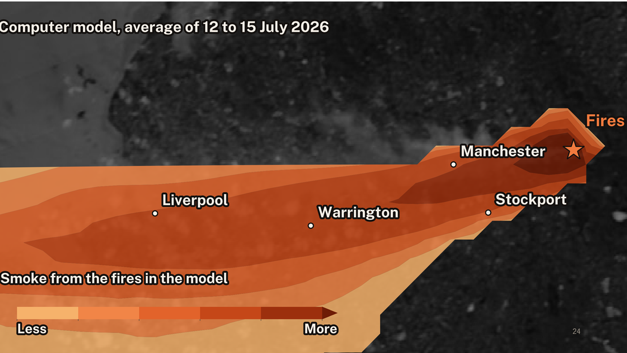
It likely won’t have escaped anyone’s attention that there were significant wildfires during the extreme heat this summer in the UK. So at September’s Open Data Night, we were lucky to welcome three expert speakers, Clare Nolan, Dr Congbo Song and Dr Gail Millin-Chalabi, to share what they know about this growing problem. But much of what they said couldn’t be captured in a short piece, so you can download all of the slides at the end of the blog.
What happens on the ground
First up was Clare Nolan, who is a Strategic Data Analyst for Greater Manchester Fire & Rescue, which she was keen to highlight means she isn’t out fighting wildfires.
Clare highlighted that there is no single definition of a wildfire and so she flagged various ways the National Fire Chiefs Council judge them. This is by the size of the fire, the size of the flames, the number of fire engines or the time committed, or that it presents risk to life, the environment, property or infrastructure.
This year has been the worst for wildfires in Greater Manchester, a total of nine, and though there is variation, the numbers are broadly increasing. However, in terms of resources, both the Saddleworth Moor and Winter Hill fires in 2018 required more than the one at Dove Stone in 2026.
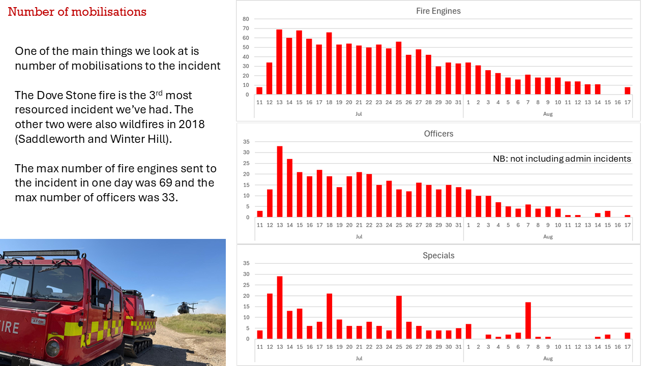
GM has 52 fire engines for a population of 3 million people. A lot of data work is therefore needed behind the scenes to make sure there are enough fire officers and the right equipment to control wildfires, including using an internal Geographic Information System (GIS), the government’s collaborative platform Resilience Direct and Ordnance Survey’s Mapping for Emergencies service.
This is all alongside supporting other forces when they are in the same situation, and of course ‘business as usual’ tasks. Up to 40% of the force’s time is spent on false alarms and there is constant effort made to reduce this, such as by education initiatives in schools.
Clare said work is now being done at a national level to try to prevent wildfires and build national resilience.
What we’re experiencing indoors
Dr Congbo Song from the University of Manchester shared his team’s work on understanding the effects of this summer’s wildfires in Greater Manchester on people indoors. This involved combining eight sources of open data, such as NASA satellite data for managing fires (FIRMS) and the Energy Performance Certificate (EPC) register for homes, along with sensors in the houses of people with cystic fibrosis.
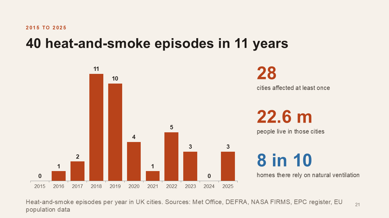
The UK Health Security Agency’s advice this summer was to stay indoors and keep windows closed, but the researchers found that often the smoke was worst on the hottest days, and at night people opened windows to cool down.
“The advice asked them to choose between heat and smoke, and hot nights are bad for health too,” Congbo said.
The team can tell when people open windows because this is when CO2 readings drop on their sensors as our breath escapes outside. But even with windows closed, bedroom air quality can vastly exceed World Health Organization (WHO) limits.
Interestingly, air conditioning and extractor fans in kitchens were found to have limited effect on this. The only thing that kept levels below WHO limits was air purifiers with a High-Efficiency Particulate Air (HEPA) filter.
The team recommends the need for: decisionmakers to combine heat and smoke warnings, for smoke spikes as well as averages to be reported, for vulnerable people to get access to combined air purifiers and air conditioning units, and for building rules to be changed to consider fresh air and overheating together.
What we can observe from above
Dr Gail Millin-Chalabi has been studying wildfires since 2002 and has been working on the development of a Fire Danger Rating Systems (FDRS) to combine data about landscapes and weather to estimate the likelihood of wildfires.
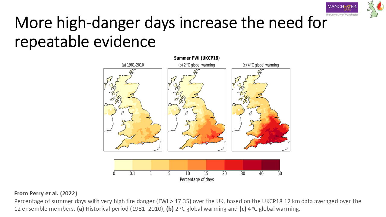
She explained that there is no single ‘fire record’ so those working in this field must combine different data sources. Her work has focused on using different Earth observation techniques to understand how the landscape acts as fuel and how it changes following a wildfire.
The UKFDRS project also sought to combine information from experts, such as local land managers, with data sources to understand wildfire risk.
Gail highlighted tensions between those who advocate for managed burning, where land is intentionally burned to try to control conditions, and those who favour rewilding to create different conditions. One problem following wildfires near reservoirs is ash getting into the water, causing discolouration and contamination, which she said may be best controlled by the creation of leaky dams to control water flow.
Gail called for more governance on wildfires, including free sharing of relevant data.
We dedicated the evening to Gail’s PhD supervisor, Dr Julia McMorrow, who was integral to getting wildfires added to the government’s National Risk Register, which monitors the most serious risks to the UK.
Download all of the slides from the event here.