OpenStreetMap is a free, editable map of the world. Often described as the ‘cartographical Wikipedia’, it’s incredibly detailed and entirely crowdsourced. You can access it right now, and use it in a multitude of ways and for a variety of purposes. It’s all open-source too.
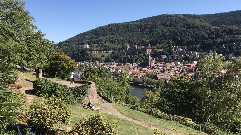
State of the Map is the annual conference for all things OpenStreetMap (OSM). Each year, OSM enthusiasts, mappers, businesses, and even those completely new to OSM gather to discuss all things OSM. This year the conference took place between 21–23rd September in the lovely Heidelberg, Germany and hosted at the Ruprecht Karl University of Heidelberg.
This year was not only Open Data Manchester’s first time attending, but with a slot in the main hall to present a talk on the Mapping Mobility Stockport project too.
It would have been easy and far quicker to hop on a plane from Manchester to Frankfurt, but in order to keep our carbon footprint low (and our sense of adventure high) I was sent all the way by train using a nifty Interrail ticket. 14 hours of travelling, through 7 stations, 5 trains and 4 countries, I arrived at Heidelberg for a sun and map-filled weekend.

I was struck by the diversity of the talks — from exploring different types of ‘mapathons’, to project-based presentations like mine, from deeper technical explorations of OSM tools, to looking at how OSM powers Norway’s transport system.
From conversations with people who’d been before, it seemed that last year’s ‘controversial topic of the year’ — A.I. and machine learning in mapping — has been embraced somewhat. Many of the talks lauded the efficiency with which A.I. machine learning was being utilized to map areas with greater accuracy, although almost all were careful to stress the importance for human validation in all processes.
A big theme on Monday seemed to be how to map for pedestrians. The National Trust’s talk explored how they’re using OSM to map their tracks and trails with greater accuracy. One nice example showed how the officially mapped bridleway was actually moved due to OSM’s version being more accurate.
And a few others, such as Routago’s routing for pedestrians and CycleStreets, explored how the ever complex ways in which we need to map for humans and cyclists are forcing developers to come up with ever more novel ways to present and use this data.
For example, one street consists more of simply one road. Unless it’s a one-way street, it actually consists of two flows of traffic. There’s usually two pavements too. And there may even be a number of cycle lanes. One street, but many flows of movement, and that’s not even taking into account data points such as traffic lights, kerbs and anything else that may affect one’s journey.
There were plenty of suggestions of how to manage these with more efficiency, and I’m looking forward to see how these things develop over the next year or so, especially keeping mapping for accessibility in mind. As was the crux of my own talk, we need to start thinking about how we not only map the pavement as a separate space from the road, but how certain features — bollards, lampposts, width, camber et al — mean that the pavement itself, whilst relatively unchanging, is actually a different terrain if you have mobility or visual impairments as opposed to if you are able-bodied.
Of course some argued — and Jorge Luis Borges would certainly agree — that the map itself can get too complex, and question whether we even need a single database like OSM for such complicated and granular information. Perhaps this was the ‘controversial topic of the year’…
One particularly powerful talk from Martin Dittus and David Garcia entitled Caretography explored systematic bias in Wikipedia and OSM. Can you even have a single map suitable for everyone, when everyone comes from different backgrounds, different cultures and different viewpoints?
Should we even strive to have one?
Whilst many of the excellent talk focused on the more technical aspects of working with OSM, particularly in terms of pedestrian routing, my own talk focused purely on the human experience. OSM itself has been built up via the human experience — editors map what is on the ground, and take what’s on the ground as gospel — but even so, as the Caretography talk so well expounded, we must make sure we’re not mapping for people and communities but with them.
This drive towards a more inclusive map extended much further over the weekend, with a great session on diversity and inclusion within the OSM community itself, attended by an encouragingly large number of people, and I was thankful to be given the opportunity to hear the experiences of people from different backgrounds from all over the world.
There were a lot of talks to take in, and a lot of information to process, and I was happy with the chance to present the Mapping Mobility Stockport project. There was a lot of interest, some good conversations about how other people are doing similar things, and I came away feeling greatly inspired.
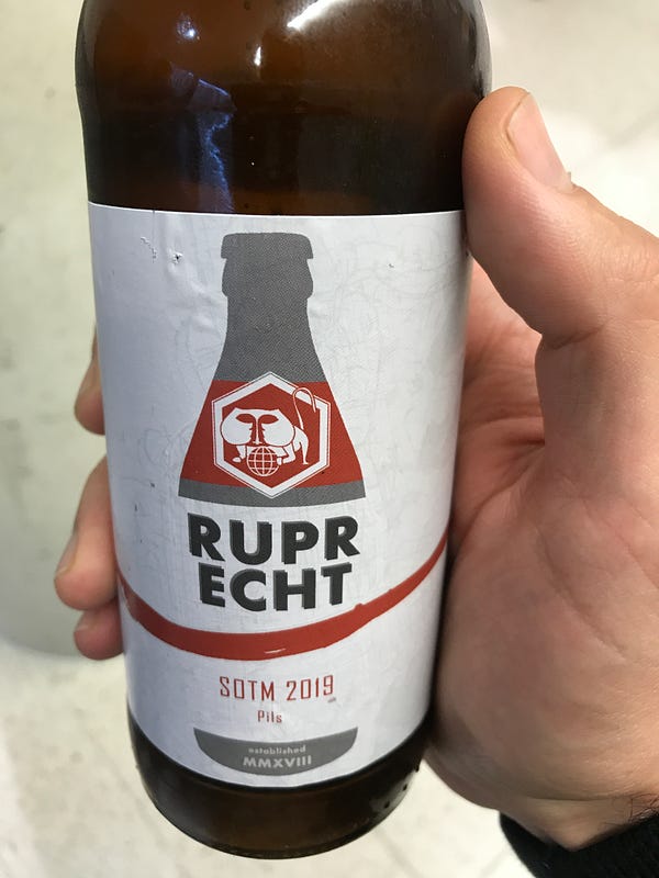
But it wasn’t all talks and maps. There was the Saturday night social, the Sunday night poster session, which came with its own specially brewed SOTM2019 local beer!
And there was time to explore Heidelberg itself — an absolute beauty of a town, with extremely friendly locals. We were lucky enough to have some great weather, so there was plenty of opportunity for some sightseeing. The old town was simply stunning, and well worth a visit if you’re able to.

Come Tuesday, the conference was over and it was time to head back to Manchester. Another 14 hours of travelling, through 7 stations, 5 trains and 4 countries (in case you were following…).
View all State of the Map talks.
Read more about the Mapping Mobility Stockport project or watch the State of the Map talk here.
Follow Sam or Open Data Manchester on Twitter.
Sign up to Open Data Manchester’s monthly newsletter.